Map Legend
This article explains how to use the Map Legend feature in Encompass Mapping to customize the information displayed on the map. The Legend, located on the right side of the map, can be expanded or hidden, and users can toggle individual items on or off, such as Vehicles with ELDs or Vehicle Tracking devices. It also provides information on traffic color coding, traffic camera locations, and weather overlays. Users must zoom in at least 50% for traffic color coding to display properly. The Legend helps improve map readability and allows users to focus on relevant data for monitoring and dispatch purposes.
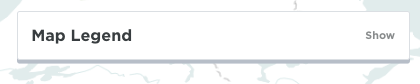
The Legend is found on the right side of the map and can be expanded or hidden. Click Show to view the legend.
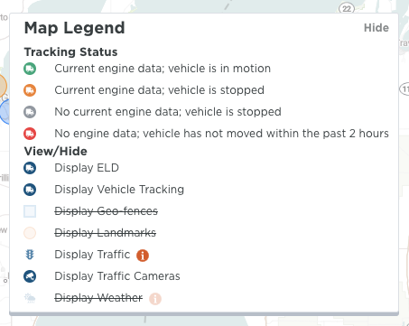
Individual items can be shown or hidden on the map. For example, if I have vehicles that have ELDs and other vehicles that are using Vehicle Tracking and I only want to see the Vehicle Tracking units, I can click on Display ELD to strike through that item in the legend and the map will not display the ELDs.
About Map Legend
- Click the 'i' icon next to Display Traffic for a key to the color coding of traffic.
- The map needs to be zoomed in at least 50% in order for Road Traffic color coding to display.
- Colored numbered circles displayed on the screen indicate there are that may Traffic Cameras in that given area. Zooming into that area, will allow for the individual cameras to display.
- Below is a key when the Weather is displayed on the map.
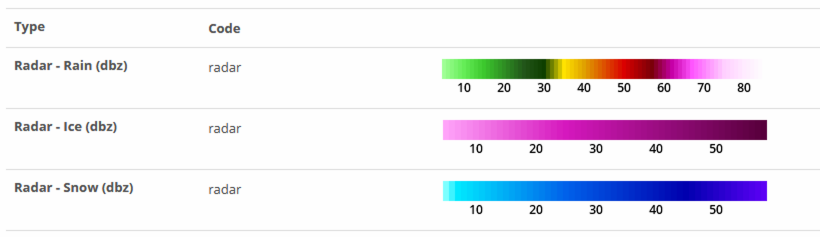
Legend from www.aerisweather.com